GIS: For several years I made my living creating interactive online maps which utilitised GIS (Geographic Information Systems) techniques and software (mostly ArcGIS). I have a degree in GIS from Penn State.
For information on John Middendorf's GIS patent, click here .
Projects included GIS work such as digitising, georeferencing, and analysis.
GIS Presentation, and a GIS course I taught at a local community college.
Additional map work, including Lechuguilla exploration mapping.
Below is a sampling of commercial projects (formerly lynxgeos.com):
LynxGeos GIS Projects
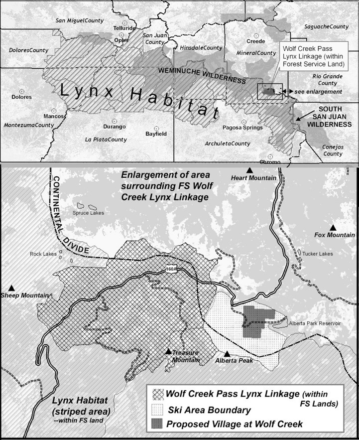
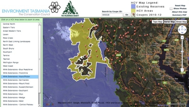
Tasmania High Conservation Value Forests
Lynx Geosystems has created an interactive online map for Environment Tasmania and the Wilderness Society showing their HCV (high conservation value) areas. Note how this map shows “Polygons with Holes”, which required complex coding using the Google Map API.Lynx custom developed a custom Shapefile to Encoded Polyline converter specific for this task (see below).
Recommendation from the Wilderness Society:
John Middendorf has exceptional skills at developing online maps as well as excellent ideas about how to make the most of this technology. The High Conservation Value Forest online interactive map John created for the Wilderness Society has proved invaluable for allowing the public to easily access and understand a large amount of complex data, something that normally requires specialist skills and software. John’s professionalism is evident in the presentation and elegant interface of his work, and the attention to detail and accuracy. Furthermore, John is efficient, reliable and a pleasure to work with.
--The Wilderness Society (Tasmania) Inc.
Maps for Bob Brown, Australian Environmentalist and Senator:
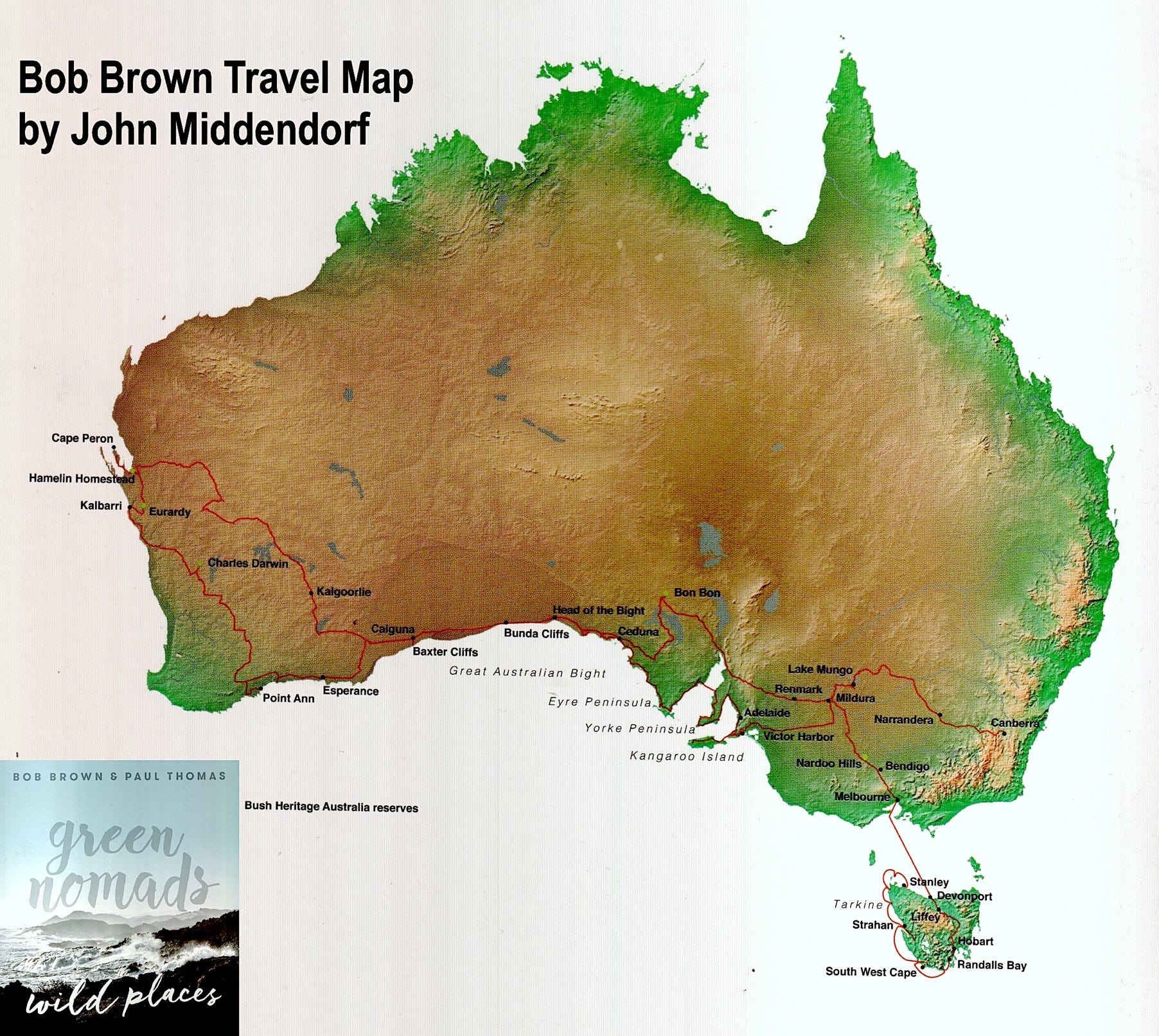
This map was created for Bob Brown's travel book, Green Nomads, Wild Places, and was featured in the opening pages of the book.
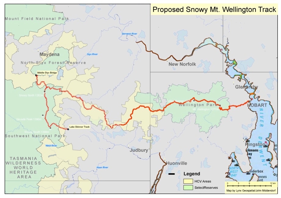
This map was created in Bob Brown's Hobart office working directly with Bob Brown. The goal was to establish another iconic Tasmania trail from Mt. Wellington to the Styx forest. The map was produced for both presentation to the Wellington Trust and for the Mercury newspaper.
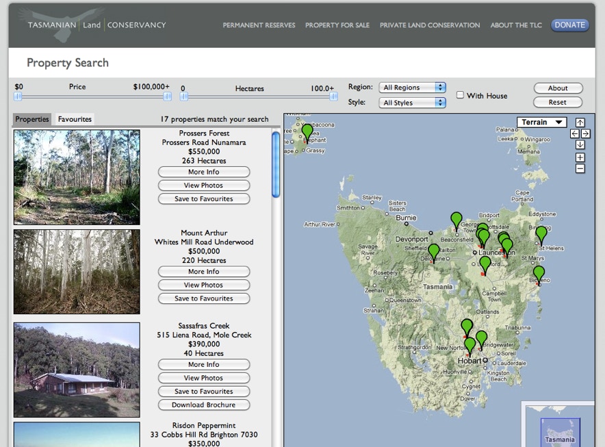
Property MapSearch for the Tasmanian Land Conservancy
The Tasmanian Land Conservancy “revolves” properties, and required an interactive map that showd the complete details of each property, along with a map that shows the property boundaries and the properties relationship to surrounding conservation land. LynxGeos was chosen to implement their online “Map Search”. LynxGeos also created a separate Online Interface for this solution, which allows the Tasmanian Land Conservancy to add/edit/delete properties that appear on the map. All data, as well as the map itself, is stored in the “Cloud”, so the map will respond quickly to all web requests, whether it has 100 or 100,000 simultaneous users.
The Tasmanian Land Conservancy provided a glowing report:
Hi John – I’d like to thank you for your great work for our Revolving Fund, done in a timely fashion.
Your interactive property map has helped us share information of our properties in an elegant and easy to use way. It is simple to use, yet displays a lot of complex information, including our properties boundaries, in a speedy way. Best of all, it is a complete standalone component of our website, and does not require any maintenance or work by our IT department, yet I can add, edit, and remove properties quickly using our custom admin interface.
Thanks so much for your help and all the best for your company.
-- Tasmanian Land Conservancy
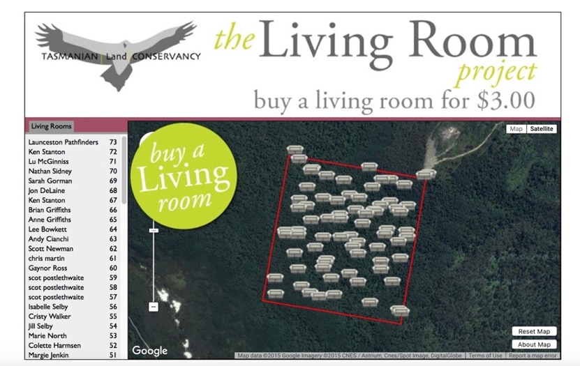
Tasmanian "Living Rooms"
When the Tasmanian Land Conservancy wanted a fun, interactive fund raising web based map, LynxGeos created the Living Room Series. Donors could "buy" a living room on land protected by the TLC. The live interactivity of this site required careful coding! Jane Hutchinson, CEO of the TLC, mentioned that the art curator David Walsh was impressed with the site during it's live opening in Hobart, an honor.
Tasmanian Property Search
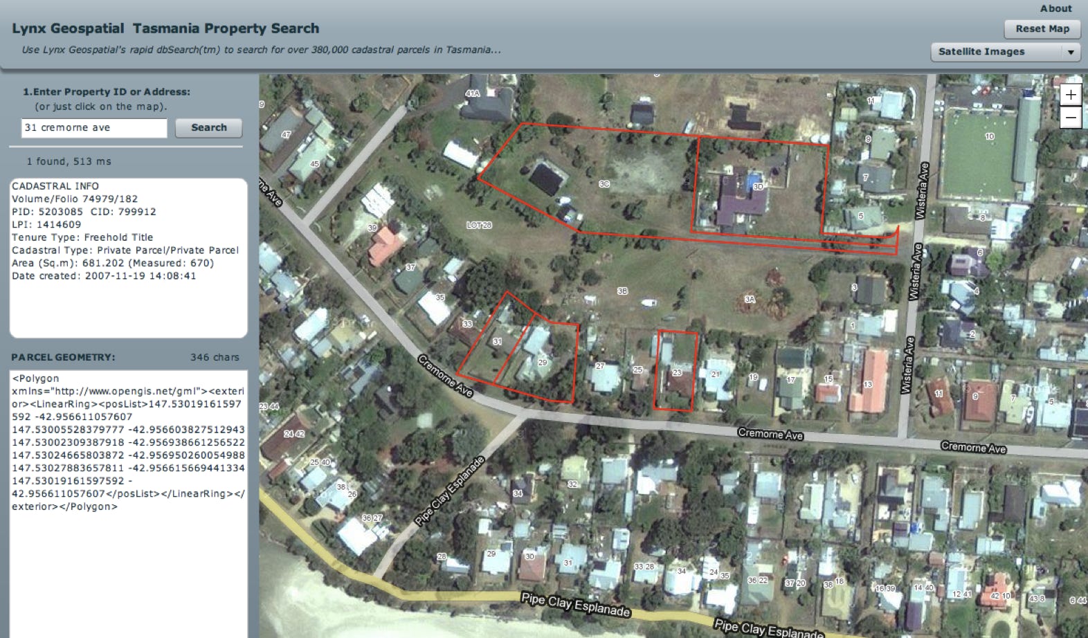
This map was created as a tool for the Tasmanian Land Conservancy to be able to quickly look up parcels in Tasmania. Using proprietary Lynx database algorithms and optimization, it is by far the fastest parcel search engine available, searching over 380,000 parcels in a few milliseconds. Compare this with Tasmania’s official parcel map, The List, which takes a second or two to retrieve each search request.
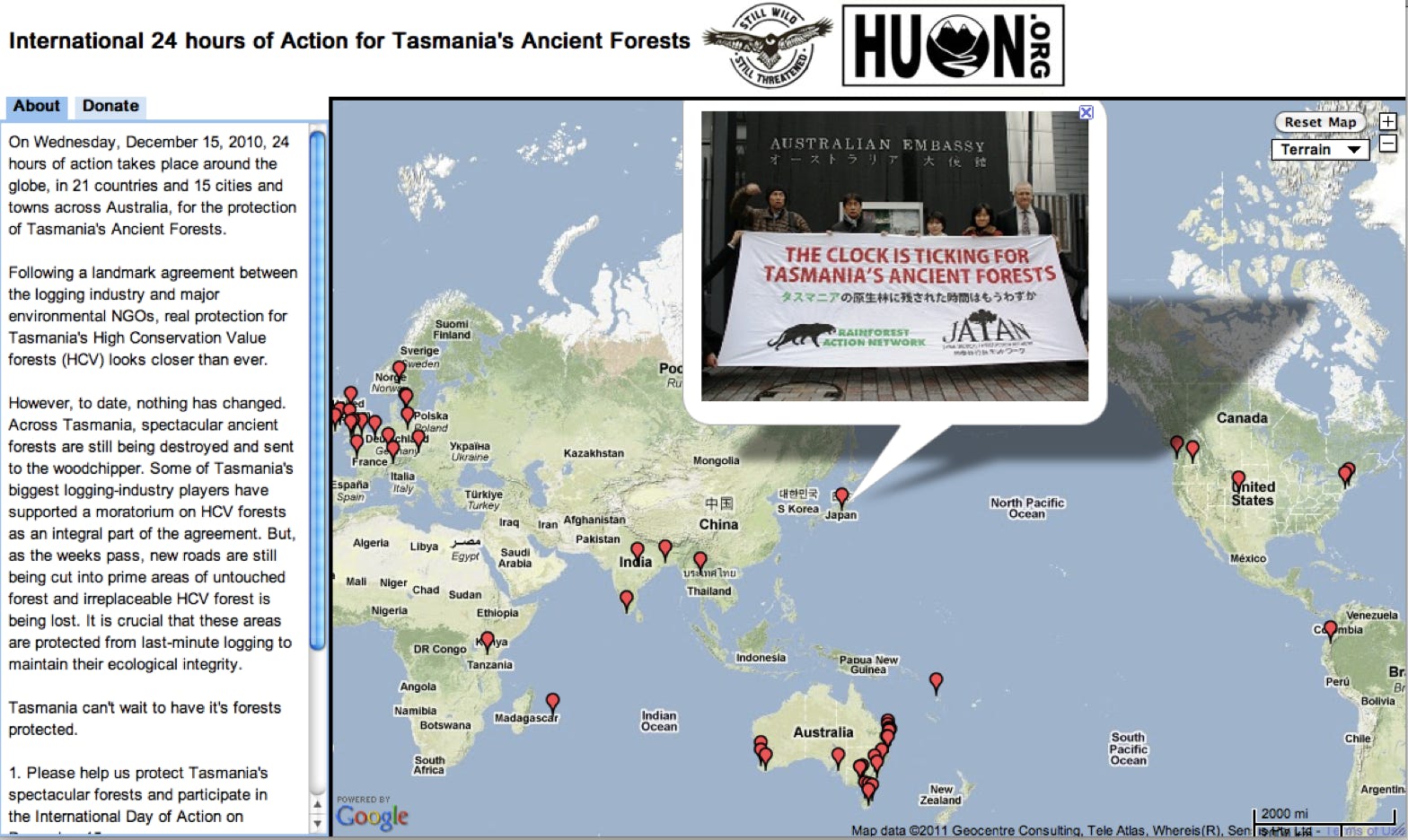
Tasmania Forests Interactive Protest Map
This interactive map was created for Still Wild Still Threatened and the Huon Environmental Group for a 24-hour protest they organised.It showed photos from around the world on a simultaneous global protest and was updated dynamically.
Lynx iPhone Apps
Lynx Geosystems has created many popular iPhone and Android Apps:
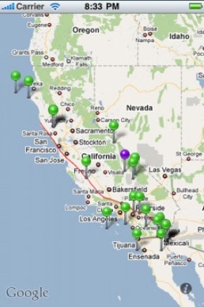
CalQuakes–an earthquake mapping application for California (over 20,000 downloads)
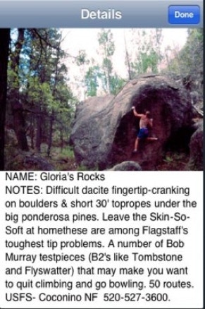
RockNRoad AZ– This was the first iPhone climbing guide with interactive map features. For VIDEO click here.
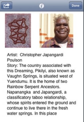
Dreamtime–Australia Aborigine Art App for iOS
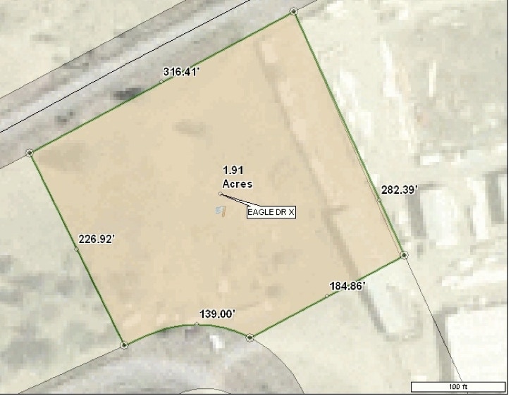
Shapefile to Encoded Polygon Converter
Another popular Open Source tool from Lynx Geos for use with Google Maps.
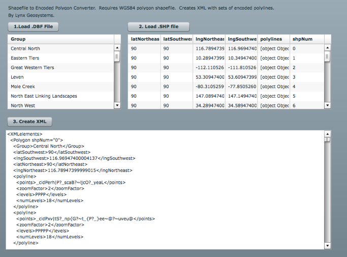
This tool will process complex shapefiles, and display polygons with holes, if there is an interior polygon. Showing polygons with holes is not a trivial feat with the Google Map API!
GIS Programming: rets2cloud and SQL to SDB tool (2010)
Lynx Geosystems offers solutions to sync Real Estate Transaction Standard (RETS) servers with cloud servers on a daily basis. The product is Rets2Cloud, and is currently in usewith the largest Real Estate Multiple Listing Services (MLS) in the country, including the Texas NTREIS.
Lynx Geosystems is proud to offer a new tool for Cloud Database users: SQL2SDB, for syncing a SQL server with the Amazon Simple DB cloud database. Features: Command line program runs on Windows. Uploads entire SQL table into Amazon Simple DB with quick setup. Syncs data upon successive runs using smart algorithms.Chunks large fields into 1024 byte units for Simple DB compatibility.
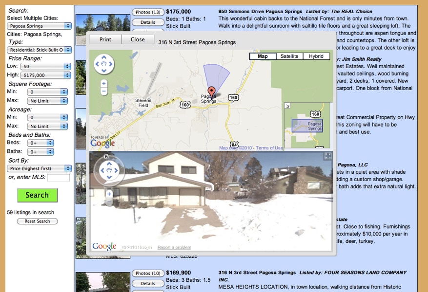
Visual IDX Visual IDX is the most advanced IDX in the world! (at the time, it was!) Click below to see Visual IDX in action
Simple IDX Lynx offers both simple and advanced IDX sites. Note how our Streetview shows the direction on the main map.
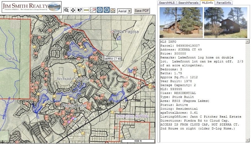
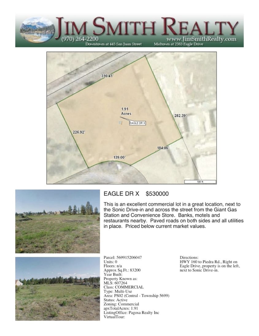
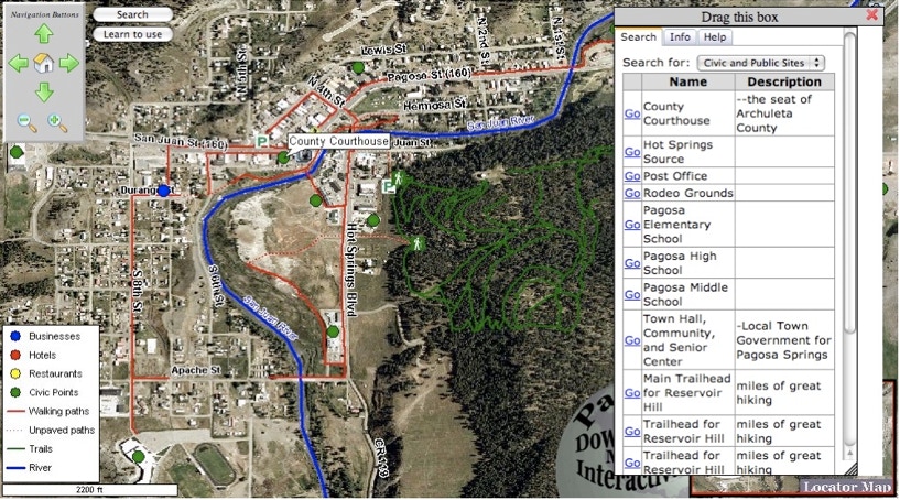
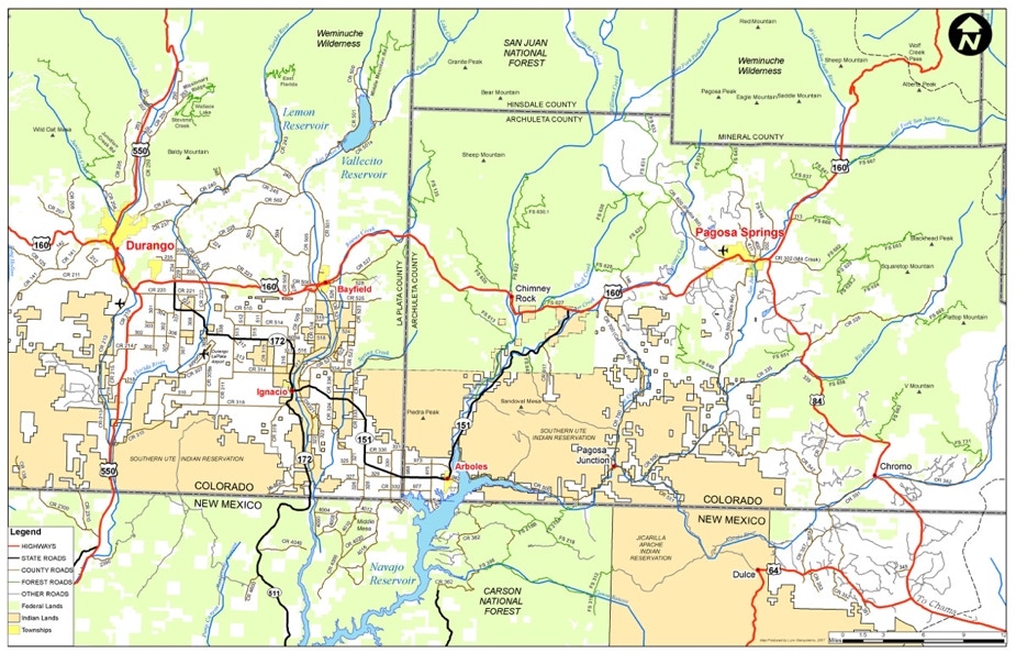
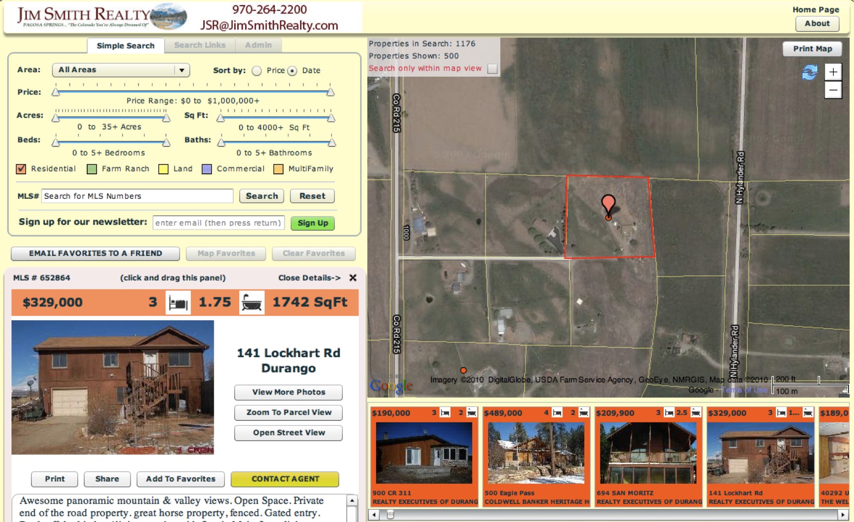
Interactive Custom Branded Real Estate Parcel Maps
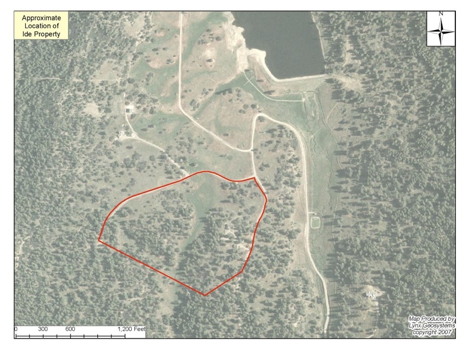
LynxGeos can create custom, easy-to-use yet extremely powerful maps to enable efficient information services. The Lynx Parcel map for Archuleta County has been exceptionally popular, with over 40 clients. It is much quicker, more conveinient, and has additional features than the county map. The custom branding allows realtors to quickly create PDF’s of properties in Archuleta County.
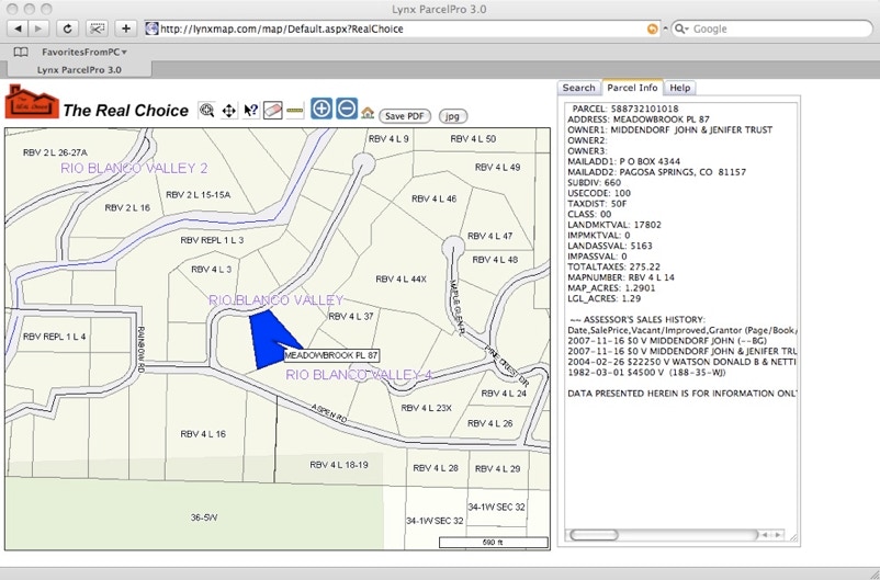
The above software uses the patent-pending boundary program mentioned at top of page. Click below to see the site in action